Highs in the 80s again this afternoon,
weak cold front by Friday
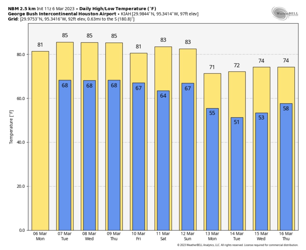
HOUSTON, Texas (KTRK) -- No surprises with the weather today. We have some fog along the Coast this morning. Most of Southeast Texas will see some low clouds and maybe spotty drizzle this morning. Clouds should break up at times later this morning. Expect another afternoon in the 80s for highs. A weak front will drop temperatures slightly by Friday with a small chance for a shower.
Another cold front could bring some cooler weather again by Sunday night and Monday.
When can we get some rain to help wash away the pollen?
You may pick up a few sprinkles in the morning, but it won't do much to help tap down the pollen count. Patchy fog and low clouds are expected each morning through Thursday. Our highest chance of rain this week comes Friday when the weak cold front arrives, but it's only a 30% chance. In other words, don't expect the weather to help us out much in the oak pollen department until perhaps the end of Spring Break when a stronger storm front may arrive.
How is the weekend looking?
A weak cold front will blow in Friday, but warm temperatures will start returning later in the weekend. Saturday could stay in the 70s to near 80 for highs, but Sunday could become more humid and in the 80s for highs. Another front arriving late Sunday will usher in lower humidity for the evening and cooler temperatures for Monday.
Is any cold weather coming to start spring break?
Another cold front will move through the Southeast Texas late Sunday and Monday, but the coldest air will stay much farther east. We could see some cooler mornings in the upper 40s and 50s by Monday, Tuesday, and Wednesday, but afternoon temperatures should stay at least in the 70s for highs.
abc13.com/houston-we ather-forecast-today -near-me-texas-rain- storm-predictio