


Stage 1 flood alert for the entire Houston metro area, through T
Stage 1 flood alert for the entire Houston metro area, through T

This discussion has been locked.

Joined:
X days ago
# Posts:
X,XXX
Contributor Points:
X


Stage 1 flood alert for the entire Houston metro area, through Thursday, to account for the potential of street flooding. Much of the Houston area should pick up 2 to 6 inches of rainfall through Thursday, with a few areas seeing higher bullseyes. This post describes what to expect, when to expect it, and explains why this is happening. spacecityweather.com /with-a-very-wet-pat tern-in-place-we-are -issuing-a-stag


Discussion Summary:
Houston Metro Area Under Stage 1 Flood Alert Through Thursday Due to Heavy Rainfall Forecast
Houston Metro Area Under Stage 1 Flood Alert Through Thursday Due to Heavy Rainfall Forecast
Discussion Insights:
Ask a question about this discussion and an AI bot will try to give an answer.
Ask a question about this discussion and an AI bot will try to give an answer.
Replies:

|
Stage 1 flood alert for the entire Houston metro area, through Thursday, to account for the potential of street flooding. Much of the Houston area should pick up 2 to 6 inches of rainfall through Thursday, with a few areas seeing higher bullseyes. This post describes what to expect, when to expect it, and explains why this is happening. spacecityweather.com /with-a-very-wet-pat tern-in-place-we-are -issuing-a-stag
 Andi7 : That is a really good site. No hype.
There is already a lot of activity out there. 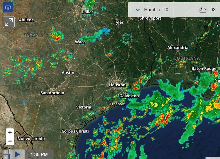
Current system that just developed north of us. 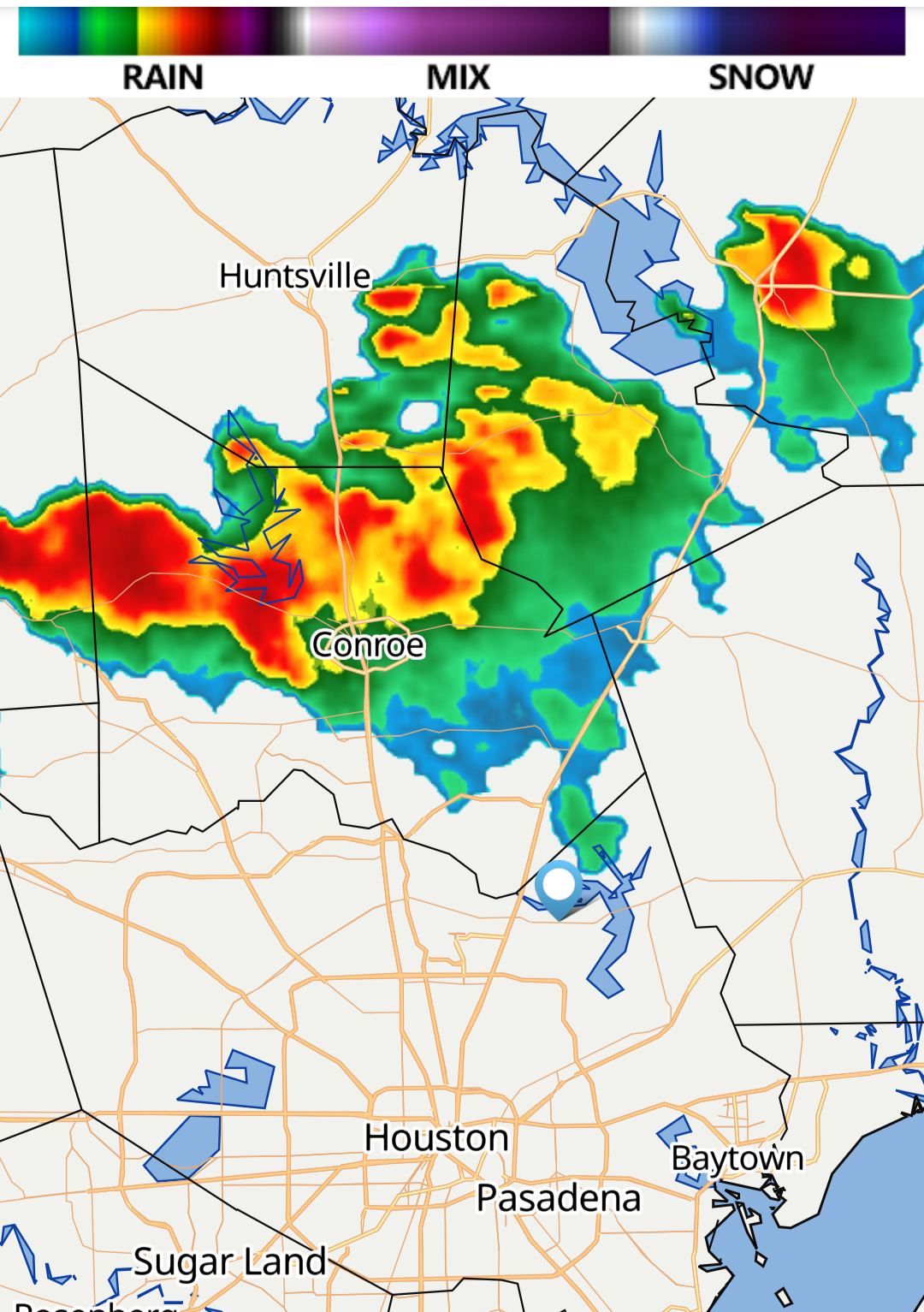
Oh crap!! I don't want this at all . My house was set with the tree and I have tarp on. I hope it holds up tomorrow.
Oh crap!! I don't want this at all . My house was set with the tree and I have tarp on. I hope it holds up tomorrow.
Maxsmom : I hope it does too.
A wet pattern As we discussed on Sunday, the overall setup for this week favors moderate to heavy rainfall, with the potential for some street flooding. The upper Texas coast will lay beneath a trough in the upper atmosphere, and our atmosphere will be laden with moisture. Tuesday and Wednesday look to have the most favorable setups for heavy rainfall, but chances will remain high from now until Thursday. In terms of overall accumulations, I think the Houston area will pick up between 2 and 6 inches of rainfall this week. My biggest concern lies near the coast, with access to the most moisture from the Gulf of Mexico. This is where we could see some bullseyes above 6 inches of rainfall this week. To account for the threat we've issued a Stage 1 flood alert for the entire region, which produces street flooding. We're closely monitoring the situation to determine whether we need to elevate this to a Stage 2 flood alert for coastal counties.
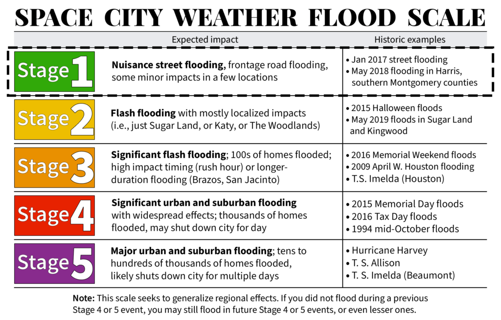
In Houston, roads are designed to flood during heavy rainfall. This is annoying, but in a generally flat region prone to heavy tropical rainfall, roads become arteries by which water is carried into streams and bayous, and thus eventually out into the Gulf of Mexico. So during intense rainfall, roads will briefly back up. This is why we repeatedly stress to not drive into high water. The bottom line is that, this week, we will need to be weather aware. Check the radar before you leave. At this point we don't anticipate significant home and business flooding, but the heavy rains will likely cause some inconveniences. We'll be here to try and pinpoint the times of greatest threats. If warranted, we will post multiple updates a day. Monday
Of the next four days, Monday likely presents the least threat of widespread, heavy rainfall. The chances today actually look best along the coast, from Matagorda to Galveston Bay; and inland, from Montgomery County northward. The most likely scenario is that each of these boundaries remain far enough apart that the central Houston region, including downtown, remains relatively quiet today in terms of rainfall. However, there is a slight chance the boundaries meet over downtown, near Interstate 10, in which case things would become more active over the central Houston area. Like I said above, keep a good radar app like RadarScope handy. Generally I think things will quiet down this evening and overnight. Highs today will reach about 90 degrees, or so, given the extent of rain-cooled air at your location.
More here:
spacecityweather.com /the-threat-of-heavy -rainfall-will-be-wi th-us-through-a
In Houston, roads are designed to flood during heavy rainfall. This is annoying, but in a generally flat region prone to heavy tropical rainfall, roads become arteries by which water is carried into streams and bayous, and thus eventually out into the Gulf of Mexico. So during intense rainfall, roads will briefly back up. This is why we repeatedly stress to not drive into high water. The bottom line is that, this week, we will need to be weather aware. Check the radar before you leave. At this point we don't anticipate significant home and business flooding, but the heavy rains will likely cause some inconveniences. We'll be here to try and pinpoint the times of greatest threats. If warranted, we will post multiple updates a day.
Of the next four days, Monday likely presents the least threat of widespread, heavy rainfall. The chances today actually look best along the coast, from Matagorda to Galveston Bay; and inland, from Montgomery County northward. The most likely scenario is that each of these boundaries remain far enough apart that the central Houston region, including downtown, remains relatively quiet today in terms of rainfall.
More here:
spacecityweather.com /the-threat-of-heavy -rainfall-will-be-wi th-us-through-a
Andi7 : We have had such a wet year! The only bonus is that the temps are cooler I guess. Limits my pool time though.
Andi7 : Agreed. but the wet ground probably contributed to the large number of trees that fell during the hurricane.
|
|

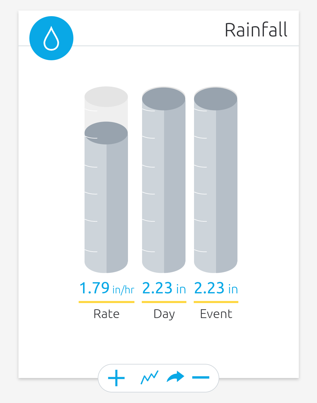
Crazy amount of rain so far.
Andi7 : Yeah, I was gettin' my hair did. Sun was shining when I went in, streets were flooding as I was leaving .... CRAZY!
This discussion has been locked.
« Back to ChatViews: 1,074
# Replies: 18